The Flower Fed Buffalo
The flower-fed buffaloes of the spring
In the days of long ago,
Ranged where the locomotives sing
And the prarie flowers lie low:
The tossing, blooming, perfumed grass
Is swept away by wheat,
Wheels and wheels and wheels spin by
In the spring that still is sweet.
But the flower-fed buffaloes of the spring
Left us long ago,
They gore no more, they bellow no more:--
With the Blackfeet lying low,
With the Pawnee lying low.
- Vachel Lindsay


Saturday, 14 July 2012

City of Rocks


It’s raining. Properly. Which is okay, as it’s the first time we’ve had a really wet day since we left Penticton. But it is raining. Hard. Thunder is resounding above and there is the occasional burst of lightning.
It’s 1:15 p.m. and we are tucked up in Big Blue below Parking Lot Rock here at the City of Rocks. We’ve had a brew, had a lunch and now Di is reading while I try to catch up on the Blog. It’s cosy in our old crock of a camper and we are happy to prop here for a while.
We got in a beautiful climb first thing this morning - a route called Skyline on Morning Glory Spire. I liked the look of the left start, which made it a 45 metre pitch. Lovely climbing on natural gear. Here is Di following:


Unfortunately - or fortunately, depending on the way you look at it - Di wasn’t feeling well, so we didn’t go on to do the three pitch “Morning Glory” on the other side of the spire. Instead, I led a a 25 metre sport route right nearby, then cleaned it. Di headed back to the van while I hung around chatting with some folks at the base of the spire until it started spitting a bit more seriously. All but one of the other cars that were here in the parking lot when we arrived back have now cleared out, most people having arrived in various states of wetness from being a bit damp to being absolutely drenched. I wonder where the occupants of the other car can be? It has probably rained at least an inch since we’ve been back in the van, and we’d have worn much of that if we’d been been on Morning Glory. So, I guess it’s fortunate in that regard that Di wasn’t feeling very perky after Skyline!

We’ve been here at City of Rocks now for eight days, and climbed on six of those. One day to do the laundry and grocery shopping and a few little minor repairs to Big Blue. 

Yesterday Di wanted a rest from climbing so she took me  on a five-hour hike. Before I tell you about that and the rest of the day though, I should backtrack to our arrival here and relate a bit about the area. (The people who own the other car still in the parking lot here have just arrived back in another car. It looks like they must have been doing a hike and a car shuttle exercise. Now we’re all alone, listening to the rain on Big Blue’s roof. It’s lovely).

I don’t know the population of the little town of Almo, which is just below The City, but it must only be about 30 people. But, because of this great park, the town has changed a lot since we were last here in 2005. Almo now has two stores (one acts as the Post Office), a steakhouse, accommodation and a hot spring/pool. There is no free camping here, but a campsite starts at $12.50 per night for a carful of people. Some campsites are okay, some are very nice and  some  are sublimely beautiful. No campsite is less than okay, and every one has magnificent views.

More about the park itself later. Now I need to tell you about Rock City Their sign will give you a hint about this establishment:


The sign is kinda misleading though. Yes, they sell pizza (and it’s very good pizza), sandwiches and even auto parts. But what they are really about is BEER! I asked one of the ladies (more about that later) working there if she knew how many different brews they have on the shelves, so she pulled out a list and counted 85 different beers (I witnessed this with my own eyes)! They’re all there, either on the shelf or in the wall of beer fridges. A couple of glimpses for you, including the Moose Drool corner ...


... and an interesting juxtaposition of various brews:


What couldn’t help catch my eye though was the poster for Easy Amber
(you've got to click on the photo so you can read the text):


There is a very warm and fuzzy atmosphere in Rock City, and they pay homage on their license plate wall to the strong climbing flavour in the area. Note the one of the plates immediately to the left of the picture:


Most days here have been pretty hot, with thunderstorms coming through in the afternoon, so we’ve passed an hour or two down at Rock City eating ice creams (true!). I’m a bit mystified at the personal arrangements down at Rock City, especially as there is a strong Mormon presence in the area. The place seems to be run by three middle-aged ladies and a bloke about the same vintage. Not sure what is the story; maybe I’ll get enough courage up this afternoon when we drive down into town to check our email to ask the Obvious Question.

Back to City of Rocks National Reserve. You’ll know you’ve arrived when you see this sign:


But before you get here, if you stop off at Park HQ in Almo you’ll see what originally brought people to the area:


City of Rocks was a major stopping off place for emigrants on the California Trail from 1854 until 1893. I think they must have brought some freeloaders on the old Prairie Schooners, because Di spotted this little fella hanging around parking lot:


We had booked our campsite over the internet from Hobart, but when we arrived the people at the Information Centre were really helpful and suggested we get a different one, as our spot had no shade. We ended up with number 25, right in the middle of The City, and here’s Di at our picnic table under some trees, which have provided some shade in the late afternoon on those really hot days:


Di’s eating corn chips, and that’s a bottle of Moose Drool in front of her, while Big Blue is basking in the background, all windows open, trying to keep cool as best he can!

One of the more popular formations is Elephant Rock which is right beside the road, and family and friends can often be seen providing moral support for their climbing relatives. This group comprised three generations plus the family dog:


This is what Elephant Rock looks like from our campsite:


Di got some other good photos from around campsite 25, including this Mountain Bluebird ...


... a cheeky chipmunk right by our picnic table ...


... and what Di tells me is a Female Dickcissel (I believe her),
a member of the grosbeak family of birds...


We can also see some more distant rock formations, including the wonderful Twin Sisters on the left which are unfortunately currently out-of-bounds for climbers:


Maybe it’s because of the thunderstorms, but the cacti have come into bloom ...


... and the other night we saw some great rainbows ...


Of course, what were really here for is the climbing. It’s hard to get good climbing photos when there are just the two of you, but here is Di following the second pitch of a route called Raindance, a delightful slab climb:


(Maybe we shouldn’t have done that route, because man it’s still raining!!!).

From the top of Raindance you look down on a terrific set of formations sporting some great climbs. In the foreground, left to right are: The Slabbage Patch, Bumblie Rock, Transformer and The Cannibal:


We also did a lovely climb called Tribal Boundaries - one of the few 4 star routes in the guidebook - and I include a photo of HJ from Bozeman, Montana for reference:


Although the climb was brilliant I thought the name was even better,
as the route follows the edge of brown patina on the rock.

Speaking of HJ from Bozeman, he was here with a mob of fellow Bozemanians. We met some of them on our first day, and they were great people to hang out with. There were four or five families and a few friends from other places in the caravansary. At least two birthdays were celebrated, including Jono's 50th, and we felt privileged to be invited along. Someone even made up a piñata for Jono's birthday last night. It had his face painted on it and needed some good hefty whacks to break it open. The Bozemanians have been coming here every year as a group for quite a while (they always get the same great camping area) and sure know how to have fun together. Not a great photo, but here are some of the mob getting ready to help Jono blow out his birthday candles:


As mentioned above, Di took me on a long hike yesterday, where we covered much of the reserve. We saw more cacti in flower, including some yellow ones ...


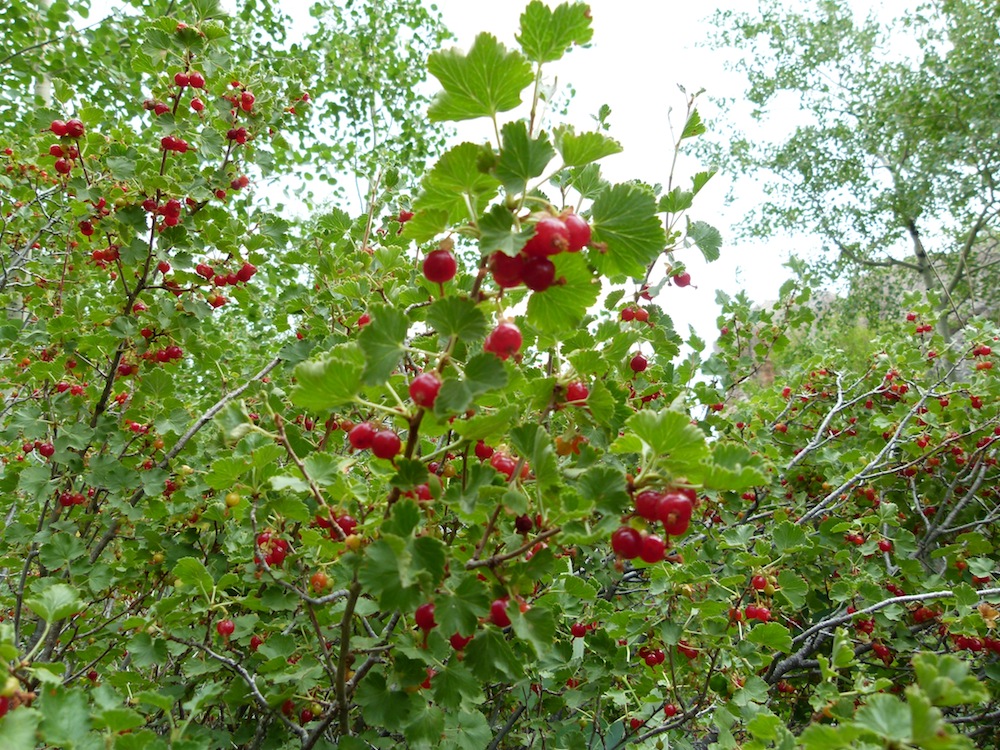
... some unknown berries ripening up nicely ...


A couple of Bozemanians, Dan and his daughter Anna, were climbing the Lost Arrow Spire as we wandered past. You can see Anna about 1/3 of the way up near the right edge:


The detail along the trail is what often makes these walks special. We saw this gossamer-like flower, or remnant thereof near the upper end of the park ...


... and stopped by a tree which had a hole in it, from which came the sounds of baby woodpeckers crying for food. Both parents were about but we weren’t able to get a photo of them at the nest feeding. Di did get a bit of a blurry photo of one of them waiting for us to get out of their territory:


We saw an interesting rock feature along the trail: two intruding dikes crossing one another:


X marks the spot?

Citry of Rocks is mostly above 6000 feet in elevation and I think is classified as high desert. Given the generally  dry nature of the environment, we wondered at the age of this beautiful tree sheltering under Window Rock's east side:


Actually, yesterday was a pretty good day, even with Di's hike taken into account. We got to Skype with the grandchildren in Cairns, which we mightn't have done had we been out climbing all day.

We’ve got another day here, but who knows if this rain is going to stop. It would be nice if we could get a couple more climbs in before leaving, but it doesn’t matter if we don’t. We’ve had a great time here and will be back for sure some time. From here we head back north, eventually into the Canadian Rockies.
Maybe it would be appropriate to finish with a note of optimism  in the form of one of City of Rocks’ special sunsets:


Until next time .... cheers from Doug and Di.


Friday, 6 July 2012

... a walk, a climb and a drive ...


Although we couldn't really get up into the Enchantments for a day walk due to the amount of snow still about at that altitude, Di was keen to have another walk and decided she wanted to have a look at the other trail that we started our last walk from. We just wanted a short walk this time, as we thought we’d like to do another long climb before we left the vicinity. That gave us lots of time for a relaxed breakfast: pancakes, blueberries and, of course Maple Syrup. This is what brekkie looked like:


Not a bad-sized jug of Maple Syrup eh: 1 litre! Will we be able to finish it off before we leave North America? My guess is YES!
It being the weekend, our little wild camping area had filled up a bit overnight. Di counted 27 cars when we got up:


Doesn’t Big Blue look cool amongst the mob!
After breakfast we drove back up the road to the start of the Eight Mile Lake Trail. We wondered what the track would be like, and it first it appeared that it was going to be mostly open country. As it turned out, we still walked through a bit of forest but not as much pristine old growth timber as the walk to Stuart Lake. There were a number of stretches that had suffered wildfire damage. What this meant though was there was an even greater array of wild flowers on display, despite it still being very early in the season.
A few highlights include the Red Columbine (there were yellow ones on the Lake Stuart walk):


Lots of Columbia Lily (also known as Oregon Lily and Wild Tiger Lily):


.... and something we haven’t been able to identify so far:


Apart from the vibrant flower displays we caught a few nice views, including this one:


If you want to see more photos from this hike you can go to our SmugMug gallery.

We were quite interested to see the numbers of people out on the trail, even with it being a weekend. We met a lot coming out from the trail who had started earlier than us and, surprisingly, quite a few still coming in when we were on our way out. It looks like the folks in the Pacific Northwest really appreciate their wilderness.


It was Sunday, and we returned to a nice peaceful campsite. Early to bed, as we had a big day planned for the morrow. We had decided to hike back up to Snow Creek Wall to do Outer Space, a 250 metre climb we’d done way back in 1986. It’s not really a very hard climb, but a fairly big day out for a couple of old codgers.


A slightly earlier start than we’d made a week before when we’d walked up to do Orbit led to the delightful discovery of a family of four mountain goats quite near the start of the trail:


Judging from the differences in size, it looked like the three kids were from successive years. Di surmised that the nanny had learned that people wouldn’t hurt her and her family and that there was lots of good food at lower elevations.


Apart from being a bit of an uphill slog at the start when you’re carrying climbing gear, it’s a nice walk in. Here’s a picture of Di entering the “wilderness”:


Before long, we were at the base of our route. We had a visit from another couple of goats. Here’s the mama (baby was too shy to stick around for a photo). You can see how she is shedding her winter coat:


Before long we were geared up and ready to go without another party in sight, which was good as our objective is probably the most popular wilderness rock climb in Washington State. Here’s what the route looks like:


Some people do variant starts that are more direct and a bit harder, but the original route suited us nicely. Up and off as quickly as possible was our plan.
Here’s Di on belay at the top bottom of pitch 5 ...


... and nearing the end of the same pitch:


We got a summit snap, had a quick bite, packed the gear away and headed down the trail.  Things went smoothly for the first two-thirds of the descent. Despite the way off being notoriously difficult to follow, given that we’d been down the route you’d think it would be a walk in the park. Well, sure enough, we got off route and ended up groveling down a series of dirty chutes and well below the base of the wall. Once we reached the trail, one of us had to hike back up to get our packs. Short straw Doug. Although this stuff-up added about an hour to the time it took us, we were still an hour and a quarter quicker car to car than the day we climbed Orbit, and felt much fresher when we finished. Are we getting fitter? Hmmm. Not sure.

We decided to head into town for a burger then drive for a few hours to start the journey south. We stopped in a small town with the rather glorious title of Othello where we treated ourselves to a night in a motel - Di had a bath! - rather than fossick around looking for a place to doss en route. We also found a Sci-Fi flick with one of Di's fav actors: Ewan McGregor and I got to find out what happened in the first stage of Le Tour. Bliss!

Our next day’s drive took us through the Columbia Basin, a huge area of fruit and vegetable cultivation in the southwest corner of Washington. We were again struck by the large numbers of Latinos in this part of the States, and their influence on local culture. There were at least four Spanish TV stations available in our motel room, and there are lots of Mexican takeaway food stores. There was even Mexican music playing outside an ATM we went past.  


On we drove into Idaho, and, via a route known as the Northwest Passage Scenic Byway, which runs east and then south along the Clearwater River Canyon, from the twin towns of Clarkson and Lewiston that straddle the Washington - Idaho border.  very pretty country, traversing the Nez Perce Indian Reservation. We continued south on to the Little Salmon River, travelling through small towns with names like White Bird, Lucile and Riggins, the latter being at the confluence where the Little Salmon joins the Salmon River, and is a popular spot for river sports.  Eventually, via the Ponderosa Pine Scenic Byway, we arrived at the gorgeous town of McCall on Payette Lake, which was our objective for the day. Di and I both thought - independently - that Payette Lake was like a less developed version of Lake Tahoe: very beautiful and unspoiled. 


Our reason for stopping in McCall was that we’d heard from our friend Jon about a great climb on a mountain called Slickrock. Here’s what the route looks like:


The climb is 10 pitches, and a great half day outing at a modest grade. We were very keen, and drove up past Little Payette Lake, where there were lots of people camping freely. (One thing that has really impressed us with Idaho is the amount and range of camping opportunities. There are lots of developed sites where you can pay to have a picnic table and fire ring, or you can use lots of undeveloped sites. And all in such beautiful surroundings!) We found the campsite we’d read about online, only a couple of miles downstream from the climb. We had this spot all to ourselves, although I had a chat with a couple of fishermen who dropped by to have a look at the river with a view to bringing their kids up to fish the next day, which was the Fourth of July. More on that later.


It was early to bed, primarily with the intention of getting an early start to forestall the mobs I envisaged climbing this fantastic route on Independence Day. I slept lightly, and was woken even earlier than I’d anticipated by a series of vehicles going past. At 4:30 I convinced Di that we might as well get up, as it was light and we could have breakfast, get on the route, finish early and be on our way south. Much to our disappointment, when we arrived at the pullout for the track down and across to the climb we discovered that the river was too high to cross easily. It was just as the fishermen had warned me the previous evening: it needed to drop "a couple of feet" for us to cross safely and for them to have a satisfactory fishing expedition. They said it should be fine in another couple of weeks, but we'll just have to give it a miss until another day.


So, southward earlier than anticipated. We followed yet another river, this time the North Fork of the Payette, for many beautiful miles along the Payette Scenic Byway, stopping at Rafting Central in the form of a staging post called Banks. Breakfast had been light and very early; time for brunch. Check it out:


They called this the “Cabarton”. And it only cost $6.95!!! 
(I managed to avoid going for the double).

While we were eating we could see people getting ready to get in rafts:


There were more rafts and kayaks waiting to be picked for their turn on the river just below where we were sitting:


And hummingbirds feeding just out the window:


After feeling much refreshed, it was east on the Wildlife Canyon Scenic Byway, which follows the South Fork of the Payette River. (I know I’ve used the phrase “Scenic Byway” a number of times, but believe me, the Idahoans are well justified in liberally coining this phrase: the drive south and east through Idaho has been amongst the most beautiful we’ve ever experienced).

There were lots of people on the river, getting ready to get on the river or getting off the river. Di shot a little video out her window as Big Blue took us past:


The next stage of the drive took us up and over Banner Summit, at 7200 feet the highest pass we'd yet crossed with Big Blue. He handled the task beautifully, just chugging along. (We are getting quite fond of the old fella, although he does need a bit of stroking now and again - more on that later).

On the way down into Stanley we stopped at an overlook for the Sawtooth Mountains:


At the Forest Service information centre in Stanley they told us that the river level at the normal crossing to the Elephant's Perch, where we intended to climb the Mountaineer's Route, was three feet deep and that the logs had been washed away. They were strongly recommending against attempting it at this stage. As Di wasn't that keen on this adventure in the first place, we decided to give it a miss and head down to City of Rocks a bit earlier than planned. It was late, so we found one of those beautiful, free campsites that I mentioned earlier, down by the Salmon River, to park Big Blue and spend the night. We thought we might have a hike in the morning, weather permitting.  However, after we'd been camped for a while, Di noticed that lights were flashing on the fridge. We surmised that the fridge wasn't getting a charge and turned it off. A problem for the morning.

The next day saw us up bright and early and on the road to see if we could sort something out.  One good thing about being on the go early is that you greatly enhance your chances of seeing wildlife. Just south of Stanley, Di spotted our first Pronghorn Antelope of the trip:


The road south goes over Galena Summit at 8701 feet, which forms the watershed between the Big Wood and Salmon Rivers. There is a charity cycle challenge that goes over this imposing pass. Big Blue handled the ascent no problems. Notwithstanding his little quirks, he's a hard worker. Reminds me a bit of Lennie, in John Steinbeck's Of Mice and Men. Maybe not too quick, but no quitter either. He just keeps on going.


Now here's something that shows just what a small world we live in: on top of Galena Summit, Di and I got chatting to a couple that had bikes and boats strapped to the top of their car (BC licence plates). The guy seemed just a bit familiar, and it turns out that it was Bill Lyons, the physiotherapist that treated me after I broke my foot in 1985. Amazing or what! Anyway, Bill suggested that we might try getting Big Blue fixed at a town called Hailey, south of Ketchum, as they had had some car repairs done there on a previous trip. Upon arrival at Hailey, I flagged down the Sheriff, and he directed us to a place that fixed us up. (Don't things often turn out good when you stop and have a chat with people?) It turns out that we needed a new Solenoid, as the old one had packed it in. I reckon that these little glitches are Big Blue just telling us that he needs a bit of loving now and again. Here's the new Solenoid in place:


We decided that we might as well get a new fuse put in as well as the existing breaker fuse was well corroded. Because we will be camping wild quite a lot, and sometimes not driving the car long distances (like when we camp at City of Rocks) we had a battery "tender" put in so that the auxiliary battery would charge up when we are plugged into mains power. Hopefully now the beer will always be cold, and Big Blue will be happy to go on a bit longer!

We'd been told by a couple of guys at the Sawtooth overlook that it was worth our while to do a side trip to see Shoshone Falls on our way south, so we did. Here's what it looks like:


We've finally arrived in City of Rocks. It has changed a lot since we were last here, but they still honour the pioneering heritage. Here's a photo of an (un)covered wagon.


 A replica I think, but I bet the folks on the California Trail would rather like the comfort of Big Blue.

According to Google Maps, it's about 815 miles from Leavenworth via the route we took, but there were a few detours along the way which took it up to around 900 miles. This is what the journey looks like:


We plan to be here at least for about 10 days. Catch you later ...