The "four aces" are four consecutive days of excellent weather and fairly intense activity - at least as far as a couple of old duffers like us are concerned - at the start of August.
The Ace of Hearts: Plain of Six Glaciers, or: "The Tea House Walk"
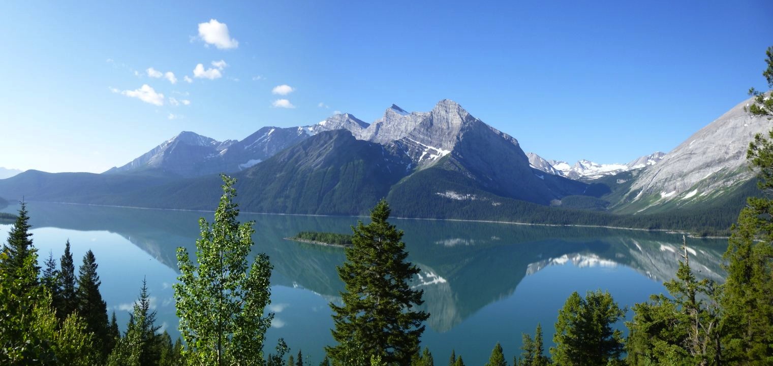
Di had wanted to walk to the Plain of Six Glaciers and visit the tea house there since we since spent the year of 1992 in Canada (she's a great tea drinker as well as a pretty fair walker, is our Dianne) and hung around the Rockies for a couple of months. She finally got her wish one day as we set off from the parking lot at Lake Louise. It's a pretty lovely spot, and we were both pretty happy to be back. Here's a view of the lake:
It was a bit of a cloudy day, so the views weren't quite as stunning as they are when the sky is that absolute blue colour. Here's Di at the lake, out in front of the Chateau Lake Louise (you'd never know the place is teeming with tourists, would you?):

We waded through the throngs to the other side of the Chateau where we spotted this fellow old duffer who seemed interested in the heights but was just a little less mobile than us:

As we made our way around the lake to the start of the trail we enjoyed these modern-day voyageurs proudly flying the Canadian flag in the traditional Canadian canoe (note the high bow and stern):

It's 5.5 kilometres from the Chateau to the Plain of Six Glaciers Tea House. I didn't get a photo of the tea house myself because of the numbers of people swarming around it, so here's one I found on the Net:

We decided we couldn't pass up the opportunity to take a small bite on the balcony with Mount Victoria looming in the background:

If you walk past the glacier for another kilometre or so, you get a great view of Abbot Hut, the second highest habitable building in Canada, which sits atop Abbot Pass at 2925 metres:

When we worked at Lake O'Hara Lodge, which is on the other side of the pass, in September 1992, we walked up to and spent a very windy night in the hut and climbed Mt LeFroy the next morning before going down to work the lunch shift (it was hard to take work seriously that afternoon after such an exhilarating time in the mountains.) Here's a photo of the hut from close up:

And here's a long view looking back at Lake Louise from in under Abbot Pass:

On the return journey we detoured past Mirror Lake and Lake Agnes, which hang like jewels above Lake Louise. Here's another view of Lake Louise from early along the Mirror Lake trail ...

... and here's a panorama of Mirror Lake:

Lake Agnes, which lies above Mirror Lake is home to the Lake Agnes Tea House. Lake Agnes is much closer to the road head, so it was more crowded and we didn't bother taking a cup of Lipton's there ...

... but we did pause long enough to enjoy a view of the lake:

All up, Di calculated that we walked about 17.5 kilometres that day. I forget what the total elevation gain was, but we did go up and down a bit. Anyway, it was a great day out although Di did complain that I walked uphill too fast! Despite that, this day out gets nominated as "The Ace of Hearts" because Di will probably hold it as one of her fondest memories on this trip.
The Ace of Spades: True Grit
The second of our four somewhat frenetic days saw us undertake the wonderful Rockies classic climb, "True Grit". I'd been keen on trying this climb for a long time and why not, with such a name! It is situated on the east end of Mt Rundle - affectionately known as EEOR which, along with Ha Ling Peak and the Three Sisters, dominates the skyline above Canmore.
Why the "Ace of Spades" you ask? Probably because - from my point of view at least - it trumps the other three in that it was the best of the four days, and maybe the best climb we've done on this trip so far. Although not as long as a couple of other routes we've done, it was by far the most sustained and satisfying. In fact I admit that I found it rather intimidating, probably because the nature of the climbing was quite different from anything we'd done recently and it took a bit of time getting used to the rock. The pitches are rated 5.10b, 5.10a, 5.10c, 5.10a and 5.10b so it doesn't let up. True Grit, established in 1990, was the first multi-pitch sport climb put up in the Bow Valley and was controversial at the time but has become a mega-classic. As such, in places the route has become a bit polished as limestone is wont to do.
Unfortunately in my preoccupied state of getting ready for this challenge I forgot to bring the camera! However, here's a photo of what the route looks like from the top of Ha Ling Peak ...

... and here's a topo of the route from Kevin MacLane's guidebook Canadian Rock: Select Climbs of the West (True Grit is route #3, and I've added a note to pitch one showing the 10b move that Kevin hasn't got in his topo):

One nice thing about this route is that once finished the descent involves a series of rappels rather than a long, dirty, loose scree slog or a long, arduous and convoluted walk off, both of which seem to be the more common for many of the longer routes in the Rockies! As I said, I found this climb a bit intimidating but it was great to get to the top, and in relatively good time. Di was a lot cooler about it all than I was, but she just had to lead the two 10a pitches! As an aside, the route just to the left of True Grit - Parallel Dreams (what a name, eh!) would be a great climb to do as well, but you'd want to be climbing a lot better than we were when we did True Grit: it's generally regarded as 5.11a (although Kevin MacLane gives it 10d) and is a fair bit more sparsely adorned with bolts. On the day, the climb we chose was certainly an adequate and memorable challenge, and will remain one of the highlights of this trip: pity about the lack of photos, eh!!!
The Ace of Diamonds: Ha Ling Peak
We both thought a hike would be a good way to follow up True Grit, as it was another beautiful day in the Canadian Rockies. The walk up Ha Ling Peak coincidentally starts from just across the road where we were hanging out in Big Blue: the Goat Creek car park. By this time we'd spent a number of peaceful nights (after that first night when Dudley Do-Right had moved us on from the streets of Canmore and we found ourselves up at Goat Creek) there and had wondered where so many people were walking to as there is no sign marking the start of the route up Ha Ling Peak. Once we'd worked it out it made sense: the views - especially down towards Canmore - are sensational. It's fantastic to see the range of people who make their way up what is a rather steep and, in the upper sections, loose, trail.
This view of the peak after we got back from climbing True Grit was the final inspiration for our walk the next day:

It's a pretty peak, isn't it? It's only about 15 minutes drive to the start of the hike from downtown Canmore, so no wonder it's popular. The walk itself initially winds its way up through forest, gradually steepening, before breaking out onto a rocky shoulder. Here's what Canmore looks like from the top:

Here's another view across at EEOR (I've put a circle in where a number of climbs ascend) and down to the Spray Lakes Road (if you look closely you can see cars of climbers who have walked down to the Grassi Lakes climbing area):

It was amusing to see that it wasn't just folks that were enjoying the view down to Canmore. This thing that looks like a doormat is actually a marmot. It was hanging out right on the edge catching some rays and I swear it was looking down at the town ...

... but it could just as well been watching out for climbers, as a number of routes ascend Ha Ling Peak, most notably Ha Ling Northeast Face and Sisyphus Summit. These both finish pretty much right at the top of the peak where this little guy is hanging out - in fact he seems to have his home right there as he disappeared into a hole whenever anyone came too close or moved suddenly. Here he has just popped out of his hole again after being disturbed before returning to his prone position overlooking the precipice:

A self-portrait shows it's not too arduous of a walk up:

So, why the "Ace of Diamonds"? Just look at the weather for starters, let alone the easy access and terrific views. On top of that, after a leisurely breakfast we were back in time for lunch!
The Ace of Clubs: Tower of Babel
Much to my surprise, after we'd had lunch and a bit of a relax Di suggested that we climb the Tower of Babel the next day. One of the medium length multi pitch routes that I'd identified as a good objective before we left home, the Tower of Babel promises a short approach - 600 metres from Moraine Lake - and fantastic views towards Mt Temple (click here to see photos from our walk up this magnificent peak in September, 1992) as well as relatively good rock, being the same quartzite that is found at the popular climbing area at the back of Lake Louise. I sure wasn't going to argue!
So, that afternoon found us meandering up the Trans Canada Highway and turning off to the Bow Valley Parkway just past BanFF to our place of residence for the night, which would put us only a short drive from Moraine Lake and the start of our approach to the Tower of Babel. After the Plain of Six Glaciers hike we'd returned to Canmore on this road because we wanted to revisit it and enjoy a more relaxed alternative to the TC Hwy. It's a rarity not to see wildlife on the Parkway, and sure enough there were a number of elk grazing alongside the road.
Just south of Lake Louise we'd noticed a great little picnic area called Corral Creek, with no signs banning parking overnight, so this is where we were headed. An added bonus was this view of Mt Fay, taken from just behind Big Blue:

The next morning saw us make a reasonably early start. We arrived at Moraine Lake, parked and headed out on the trail. As the guide book promised, the Tower of Babel was close - in fact in plain view from the parking lot, and for the first five minutes or so the walking was great. But soon we were on the scree. Here is the Tower from just after leaving the trail:

Here we go again, we thought. Up three steps, down 2. Actually it wasn't that bad compared with some of the other approaches we have had but it was a bit demoralising after three fairly active days to have to start a multi pitch climb with yet another scree slog approach. It probably took 45 to 50 minutes compared to the 30 to 40 minutes the guide book suggests. Here's another shot zoomed in a bit showing roughly the line of the route, with the green dashes showing the traverse along a small ledge to where the climb started:

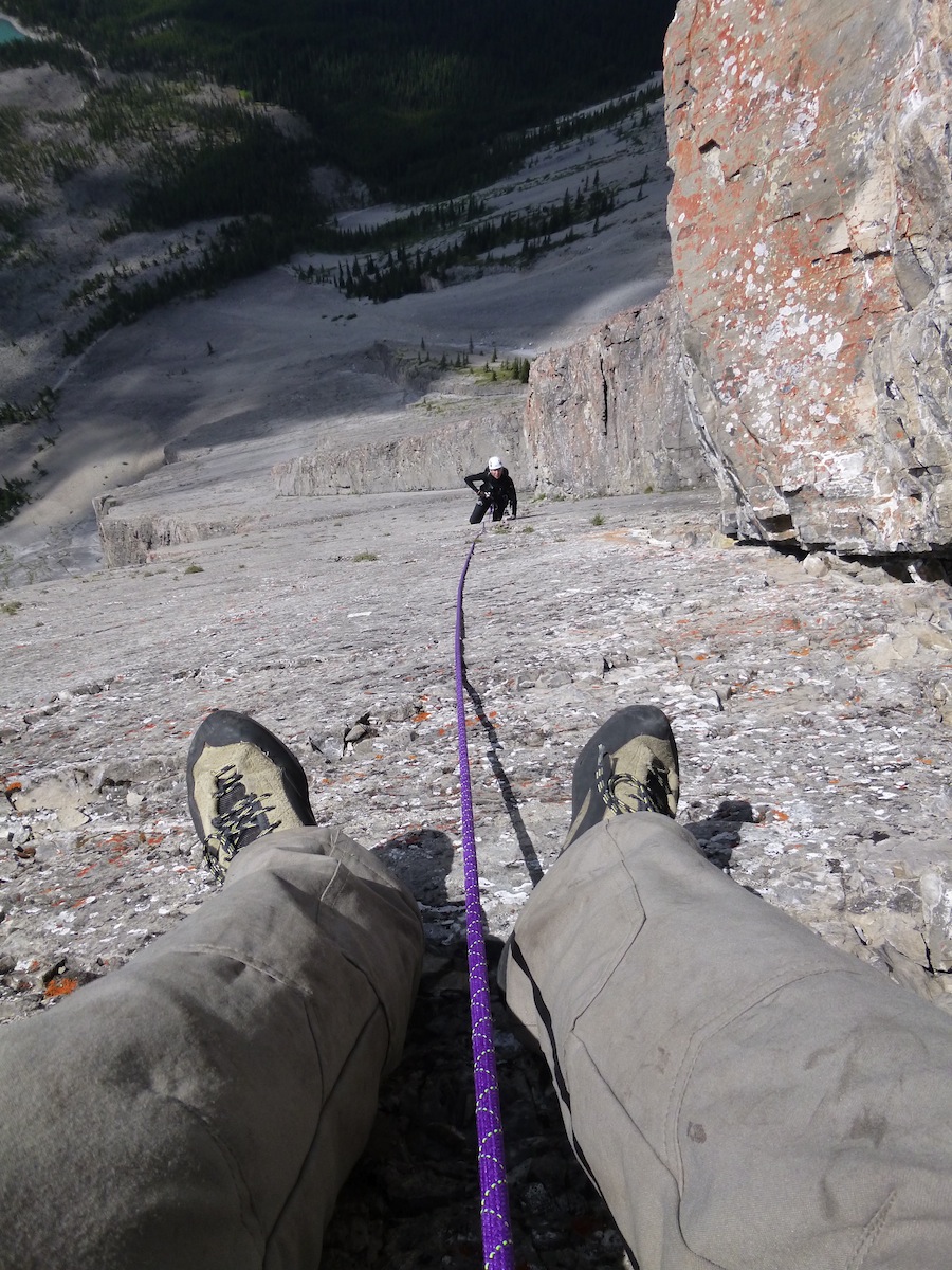
We had a bit of a discussion about where the route actually started but that didn't last long - thank goodness! ;-) - and soon I was grappling with the first pitch. It was only 5.7 but it did make me stop and think. At least the rock on the technical bit at the start was solid, unlike the rest of the pitch. Di's first pitch, which supposedly had a 5.8 move on it, started out with about 5 metres of wheatbix, but then turned good and solid as soon as the technical climbing started. This became a bit of a pattern: mostly good rock interspersed with some real rubbish that was generally easier climbing. We were a little conscious that there was a fairly high probability of a thunderstorm later in the day, so we were trying to move reasonably quickly, but still being careful with the bands of loose rock that kept appearing. Taking photos wasn't high on the agenda, and getting good shots wasn't very easy anyway due to the climb being broken up by ledges and dodging around corners, especially early on. In fact I only took one picture en route; this is Di nearing the belay on pitch 5:

We became stuck behind a party of three who had taken the alternate start a little way up the descent gully. After waiting at the start of the last pitch for over an hour it was good to start climbing again especially with cloud starting to build up around us. It was quite warm by this stage but there was little wind so we weren't overly concerned. The final pitch proved to be the best of the route. At 50 metres it was the longest and also the most solid, as well as proving to be the most sustained in terms of quality of climbing.
It's always good to get to the top of a climb, but this was especially the case with the Tower of Babel. A spacious platform of very solid rock greeted us. Di had been rather unsettled at times by the loose rock (she got the worst of it) and her initial reaction seemed to be one of relief rather than bliss ...

... but she soon started beaming:

And no wonder, when one discovers what antics people had been up to. This lovely intricate cairn is the first real sign of the games people have been playing on top of the Tower of Babel on sunny days:

Here's another one - large but not quite so beautifully put together - with its little brother standing by:

Of course, there were great views from the summit. Here's Consolation Lakes out behind the tower, with Mount Babel looming above on the right ...

... and Moraine Lake below us on the other side:

Presiding majestically over all stood Mt Temple:

But wait, there's more! Back to the summit shenanigans. Someone had constructed a whole lounge room, consisting of a couch, TV, bookshelf and coffee table. Here's Di kicking back watching TV (if she looks a bit peeved it's because I've got the remote):

She was having so much I thought I'd join her:

We were told by the other guys that we ran into on the climb that the Tower of Babel is used by guides to take clients up (this was borne out by the belay stations that had been installed on the last 5 or so pitches), so perhaps it has become a bit of a ritual to add to the fun when an ascent is made. They also told us that they'd come in from the side rather than doing the direct start because there was less loose rock. Hmmmm .... I'm still glad we did the first pitches as there was some good climbing there and it felt more like we'd done the whole route.
Okay, so we're up; now we had to get down. A couple of people had told us that the descent gully "isn't as bad as it looks", so we were tentatively encouraged. This is what the top quarter or so of the gully looks like from below ...

... and this is looking down at the rest of it:

You know, people were right. It wasn't as bad as it looks but we were still careful. However, as with most scree there was a bit of give here and there but nothing goes very far. We took it easy as we aren't that familiar with such conditions, coming from the Land of Solid Rock.
Back at Big Blue it was beer o'clock. The build up of cloud and the few claps of thunder we heard while on the summit turned out to be a false promise: we only had a few drops of rain while drinking beer. Oh yeah, we also had a sandwich, then pottered off back to Corral Creek where we both had a nice cooling and cleansing dip before dinner.
And the "Ace of Clubs"? Well, by the end of four consecutive days of strenuous exercise we did feel beat up enough for two whole days of relaxation afterwards. Besides, it's the only one left in the pack!